Ground geophysics · Mongolia
We measure the ground so you drill fewer holes.
Magnetics, gravity, IP/resistivity, ERT and NMR sounding crews based in Ulaanbaatar, for geology, water, environmental and engineering work. The people who model the data sit one floor up.
Readings are taken station by station
Crews walk every line with the instrument, and the map builds up as they go.
18 400
line-km surveyed to date
243
projects for 90+ clients
2
countries Mongolia and Mexico
6
international projects
Who it's for
Four kinds of job
The same five methods answer very different questions. What changes is the line spacing, the depth and who reads the report.
01
Geological exploration
Structure, intrusions and alteration for mineral and coal exploration, from regional gravity down to detailed IP over a drill target.
MAG · GRAV · IP/RES
02
Water exploration
Aquifers for towns, herders and mines. VES and ERT find the water-bearing layers; NMR sounding measures the water itself, so the bore goes where the water is.
VES · NMRS · ERT · GRAV
03
Environmental
Saline and contaminant plumes, old tailings and landfill edges, mapped without digging.
ERT · IP/RES · MAG
04
Engineering
Depth to bedrock, permafrost, voids and buried services, before you design foundations, roads or dams.
ERT · GRAV · MAG
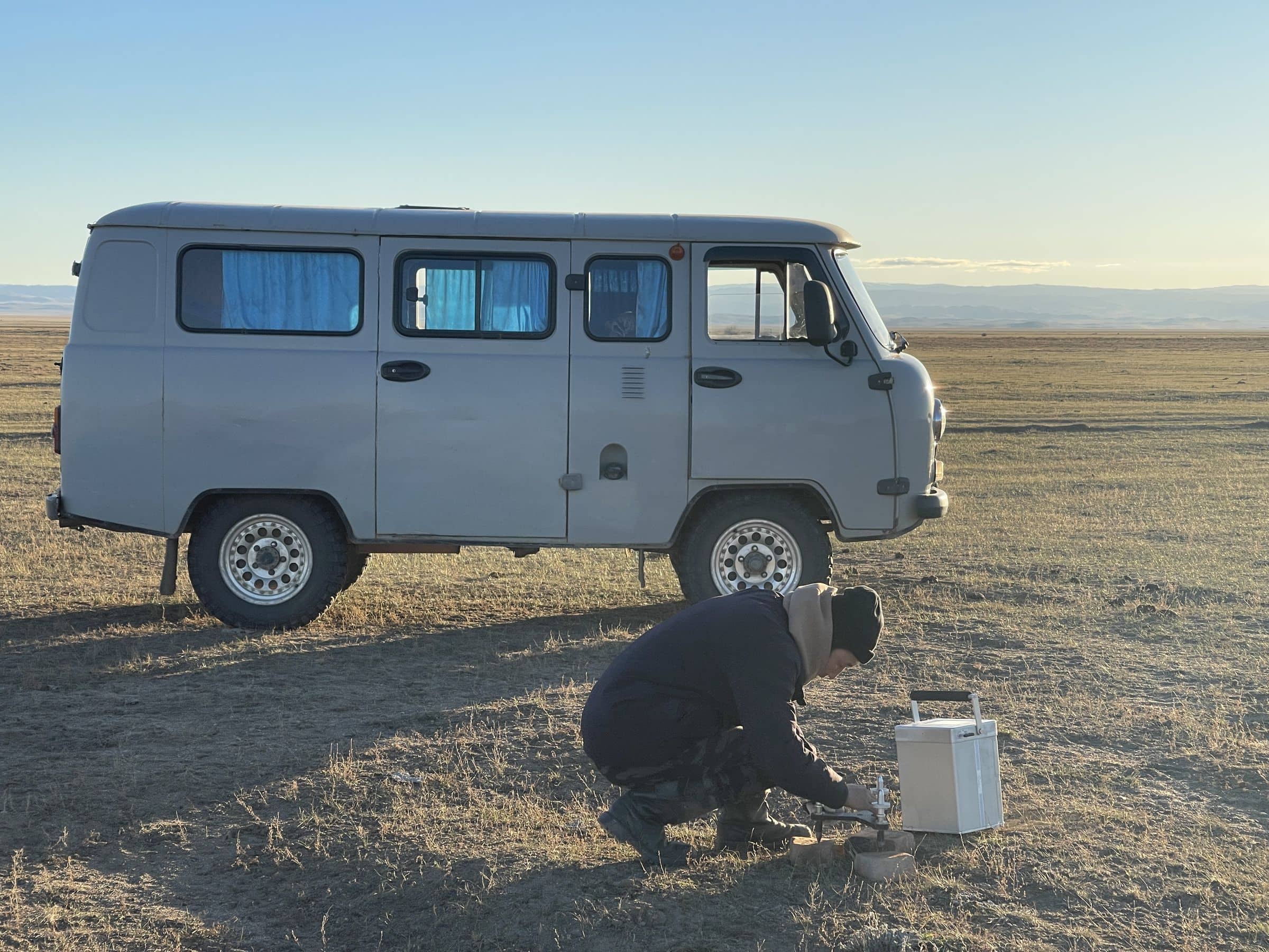
Field · 01
Base station
The UAZ goes where most vehicles won't, and carries the crew, the kit and the base instrument.
Methods
Five methods. One crew, one report.
We pick the method for the target and the budget, not the other way round. Often that means two methods on the same grid.
Field acquisition05
Office work02
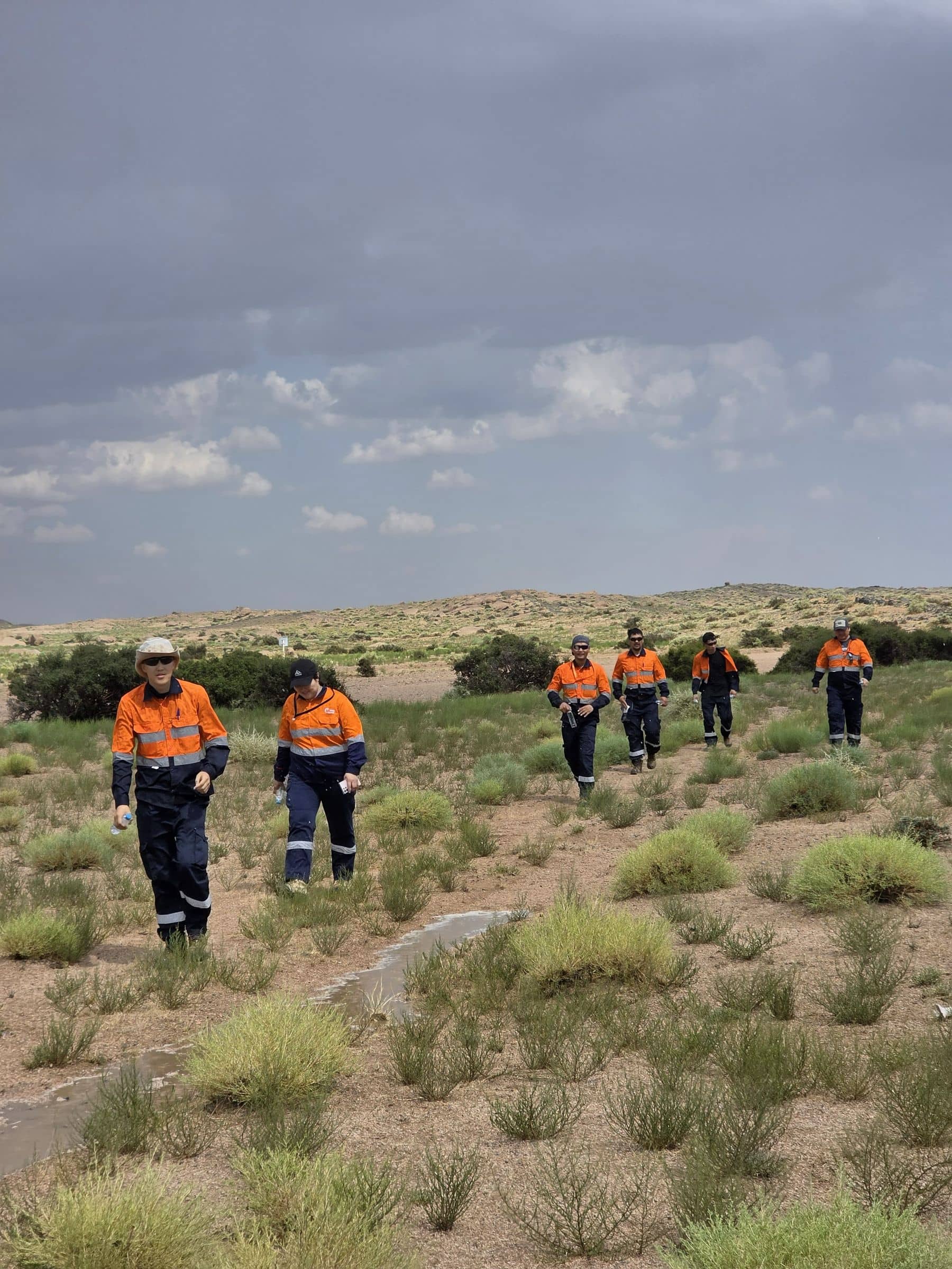
Field · 02
Walking the line
Most of a survey is walking: station to station, line after line, whatever the weather.
How a survey runs
Four stations, start to finish
STN 000
Design
We look at your geology and target, model what it should look like, then set the method, line spacing and budget.
STN 100
Field
Crew mobilises with its own camp. Raw data and a QC note reach you every evening, by satellite if needed.
STN 200
Processing
Corrections, gridding and 2D/3D inversion, done by the same people who planned the survey.
STN 300
Targets
Ranked targets, a 3D model and grids in the formats your GIS and modelling software read.
Field record
Where we've worked
Recent work for mining and exploration companies, from Oyu Tolgoi in the South Gobi to the mountains of Gobi-Altai and Zavkhan.
Drag to turn · hover a pin
Project list
Umnugobi · Copper-Gold
Gravity survey at Oyu Tolgoi
Gobi-Altai · Cu-Ni-PGE, Cu-Au
Gravity and magnetics at Oval and Maikhan Uul
Zavkhan · VMS Cu-Au
IP, magnetics and gravity at Zos Uul
Selenge · Gold
Magnetics, gravity and IP at Boroo
Selenge · Gold
Magnetics and IP at Gatsuurt
Dornod · Gold-Silver
Exploration and water surveys at Altan Tsagaan Ovoo
Zavkhan · Gold-Copper
Exploration and water surveys at Bayan Airag
Umnugobi · Copper-Gold
Gravity and IP at Kharmagtai
Clients
Who we've surveyed for
Mining companies, explorers and developers, from majors to juniors.




Send us a licence boundary.
A shapefile or a sketch on a map is enough. Tell us what you're looking for and we'll come back with a method, line spacing and price, usually within two working days.
Start a quote→